
Residential Parcel Level Landscape Measurement Data
Free to Retail Water Agencies in the Santa Ana River Watershed
SAWPA partnered with the U.S. Bureau of Reclamation to help retail water agencies develop fair and efficient water budgets for their customers. Through a pilot project, the team used high-resolution aerial imagery and advanced mapping technology to identify landscape features—such as grass, drought-tolerant plants, and paved areas—at the parcel level. Combining this information with water use data improves the accuracy of water budgets for both customers and water suppliers.
This project shows how modern mapping and data tools can make water budgeting more efficient and easier to update over time.
This webpage provides access to the data, tools, and resources developed through the project to help water agencies refine water budgets and comply with California’s long-term urban water conservation standards.
Data At A Glance
Take a look at some of the examples of information this tool can provide.


Project analyzed over 2,500 square miles of urbanized outdoor landscape

Analyzed and measured outdoor landscape features for over 60 retail water agencies

Analysis conducted using Arc GIS based Deep Learning tools
Methodology
Project Purpose:
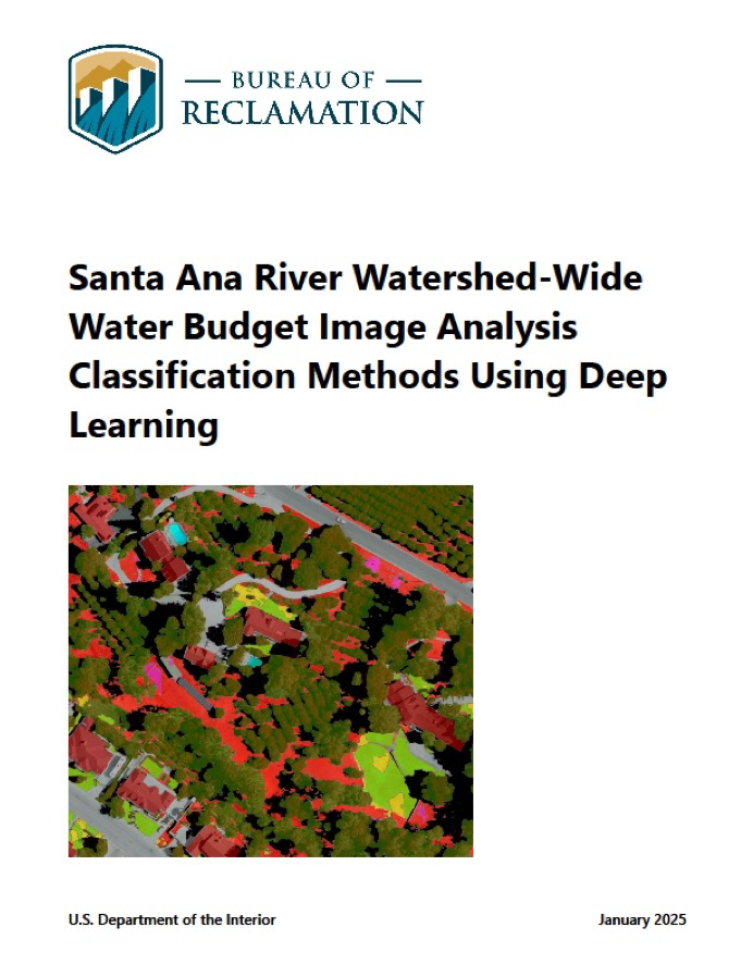
The study aims to enhance water management strategies in the Santa Ana River Watershed by utilizing high-resolution aerial imagery through deep learning (type of artificial intelligence) methods to classify land cover types, thereby aiding in the development of water budgets at the customer and water retailer levels. The motivation for this study stems from California’s ongoing water management challenges, worsened by periodic droughts and increasing demand due to population growth. These data will be made available to retail water agencies to support the creation of efficient outdoor water budgets for individual customers based upon the California State Water Efficient Landscape ordinance formula from AB 1881 for calculating Maximum Applied Water.
Project Area:
The study area includes two Southern California watersheds: the Orange County (Lower Santa Ana River Watershed) and the Western Riverside and San Bernardino Counties (Upper Santa Ana River Watershed).
Project Method:

Request Data
GIS, aerial imagery, and excel data from the USBR landscape analysis can be provided to agencies for areas within their agency boundaries. Information needed from data requestors includes:
- Agency Name
- Agency Contact Name and Title
- Contact Email
- Contact Phone Number
Data Available to Agencies:
GIS Data
- Landscape Classification – polygon layer with USBR landscape classification. This layer can be used to visualize the landscape classification on a map and can be parsed to parcel boundaries to get landscape areas for parcels.
- QC Assessment Locations – point layers with locations where USBR and SAWPA manually checked modeled landscape classification against the aerial photo.
- MSA Parsed Classification – polygon layer with USBR’s landscape classification parsed to Meter Service Areas (MSA’s). This layer delineates where each landscape classification is located within an MSA and was used to calculate landscape classification areas for the MSA Summary layer.
- MSA Summary – polygon layer of MSA boundaries with the areas of each landscape class for each MSA and other parcel information. This layer can be used to calculate water budgets for each MSA.
GIS Aerial Imagery*
- Tiled Imagery – 3” resolution, 4 band aerial imagery in 0.25 mi X 0.25 mi tiles.
- Compressed Imagery – 3” resolution, 3 band SID compressed imagery.
Excel Data
- Summary Statistics for Residential and All land uses.
- Confusion Matrices for USBR and SAWPA QC checks.
*Aerial imagery requires the requesting agency to sign a license agreement with Geophex (owner of the imagery).
In most cases SAWPA can provide the data as a downloadable link, but in instances where the agency area is very large removable hard drives may be required. In these cases, SAWPA will mail the hard drive(s) to the agency, and the agency will be required to mail the hard drive(s) back to SAWPA after copying the data
Making Conservation a California Way of Life
On January 1, 2025, California implemented the Making Conservation a California Way of Life regulation, adopted by the State Water Resources Control Board to establish long-term, statewide urban water conservation standards. The regulation requires urban retail water suppliers—not individual households or businesses—to set and meet annual urban water use objectives, which are customized efficiency goals based on local conditions and water uses such as residential indoor/outdoor use, commercial and institutional landscapes, and water loss. The framework was developed to implement state law (AB 1668 and SB 606) and is intended to embed conservation into everyday water management, improve resilience to drought and climate change, and reduce dependence on emergency restrictions. Water suppliers must calculate and report objectives annually starting in 2025, with compliance beginning in 2027.
To request data, please contact Rick Whetsel, Senior Watershed Manager, via the below contact form, or at [email protected] or (951) 354-4222.