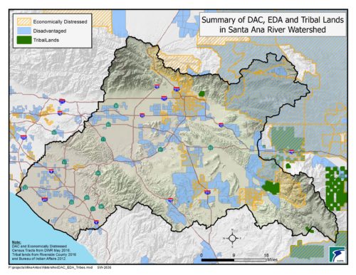
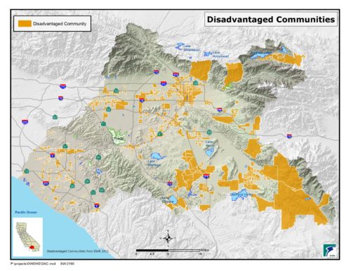
Map of Economically Distressed Communities (highlighted in orange diagonal lines), Disadvantaged Communities (highlighted in solid blue), and federally-recognized Tribes* (highlighted in solid green) within the Santa Ana River Watershed.
*Present-day reservation lands of federally-recognized Tribal governments are shown for reference only. Members of both federally-recognized and non-federally recognized Tribes are found throughout the entire Santa Ana River Watershed, and have historical and cultural ties to the entire watershed.


